This post lists the National Parks in Japan (国立公園, Kokuritsu Kōen). There are 29 of them, covering 20,482 km² (which corresponds to 5.4% of the land area). They should not be confused with Quasi-National Parks (国定公園, Kokutei Kōen, lit. Nationally designated parks, total of 56 in Japan, 13,328 km², 3.6% of land).
The area of each National Park is divided into four categories of Special Zone that determine the degree of protection. In all National Parks, generally less than 50% of the area is reserved within the two highest protection zones.
Ranked in order of protection, the zones are:
- Special Protection Zone, which provides the highest protection status and according to bureaucratic guidelines is considered an area where scenic beauty needs to be maintained and the erection of structures is prohibited.
- Class I Special Zone, Structures are also prohibited, but where scenic beauty should be maintained "somewhat strictly", a laxer level of protection.
- Class II Special Zone. Forestry, agriculture and fishing may be carried out. Buildings associated with these activities them may be built, as well as cottages and villas so long as they do not obstruct the scenic beauty of an area. Clear cutting of forests is not permitted
- Class III Special Zone. The same as a Class II Special Zone, but for areas whose scenic nature is not considered threatened by forestry and clear cutting is permitted.
National Parks of Japan
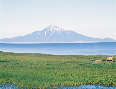 Rishiri-Rebun-Sarobetsu National Park
Designation: 1974/09/20
Area: 21,222 ha
This is the northernmost national park in Japan. Mt. Rishiri soars majestically above the sea. Rebun Island has many alpine plants such as Rebunsou (Oxytropis megalantha). Sarobetsu Plain, abundant in marsh plants, and Wakasakanai' s dunes contribute to the exciting landscape.
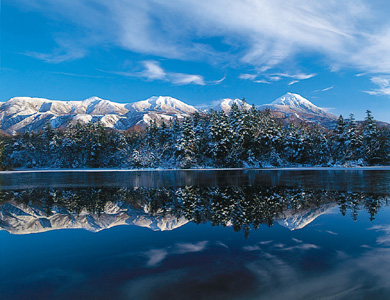 Shiretoko National Park
Designation: 1964/06/01
Area: 38,633 ha
This park is highly primeval. Sea eagles, Blakiston's fish-owls and brown bears live in the district. The view of the Shiretoko mountain chain from the five lakes is splendid. The west side of the Shiretoko Peninsula is covered with drift ice during the winter.
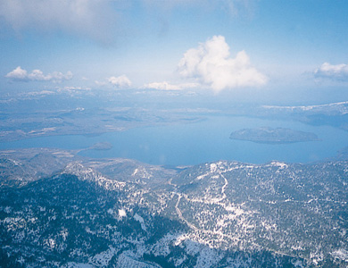 Akan National Park
Designation: 1934/12/04
Area: 90,481 ha
This is a volcanic park, featuring such volcanoes as Mt. Meakan. There are many rare plants such as Marimo (Cladophora sauteri) in the Lake Akan area. Lake Mashu is known for one of the world's clearest lakes. Lake Kussharo, which is surrounded by hot springs, commands splendid views.
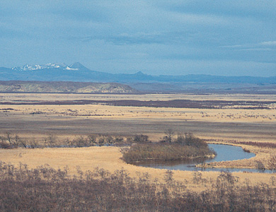 Kushiro Shitsugen National Park
Designation: 1987/07/31
Area: 26,861 ha
This park covers Kushiro marsh, the largest in the country. The meandering Kushiro River and the vast moor are visible from observatories in the park. Sacred cranes (Grus japonensis) breed in the marsh. There are lakes and marshes such as Lake Taro and Shirarutoro marsh in the eastern part of the park.
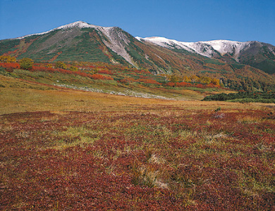 Daisetsuzan National Park
Designation: 1934/12/04
Area: 226,764 ha
This is the largest of all the national parks in Japan, and is called the “Roof of Hokkaido.” The main feature of this park is volcanoes such as Mt. Tokachi and Mt. Asahi, which is the highest mountain in Hokkaido. The park also boasts splendid views of Mt. Ishikari and alpine plants. Brown bear, Yezo deer and pika (Ochotona hyperborean yesoensis) live in this district.
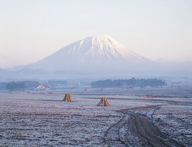 Shikotsu-Toya National Park
Designation: 1949/05/16
Area: 99,302 ha
Lake Shikotsu and Lake Toya, along with active volcanoes such as Mt. Yotei, Mt. Usu, Mt. Showa-shinzan and the newly formed Mt. Tarumae provide many characteristic views. Lake Toya is famous as the northernmost ice-free lake in Japan.
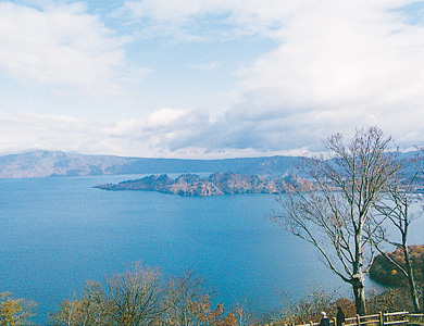 Towada-Hachimantai National Park
Designation: 1936/02/01
Area: 85,411 ha
Lake Towada and the Oirase River, which runs from this lake, make a beautiful landscape with plentiful green and water. There are volcanoes such as Mt. Iwate, coniferous forests, and many moors in Hachimantai. This park offers climbing and hot springs.
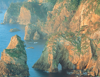 Rikuchu-Kaigan National Park
Designation: 1955/05/02
Area: 12,212 ha
This park extends along the seashore for 180 km from Kuji in Iwate prefecture to Kesen-numa in Miyagi prefecture. The rugged coastline is splendid, and is called “The Alps of the Sea.” This park offers a breeding place for black-tailed gulls, petrels, etc.
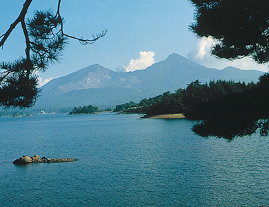 Bandai-Asahi National Park
Designation: 1950/09/05
Area: 86,404 ha
This park is composed of many mountains. Mt. Dewa-Sanzan is famous for mountain worship, Mt. Asahi, Mt. Iide and Mt. Bandai are also located within the park boundaries. The view of Urabandai and Lake Inawashiro is beautiful. This park is surrounded by mountains, forests and a lot of lakes. Antelopes and black bears live in this park.
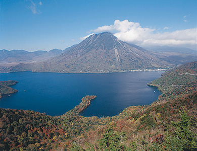 Nikko National Park
Designation: 1934/12/04
Area: 140,021 ha
Kegon Falls, Lake Chuzenji and Senjo-gahara are representative of Oku-Nikko. Oze-gahara has many moor plants such as mizu-basho (Lysichiton Camtschatcense Schott). Gorges such as Kinugawa and Shiobara, and the foot of Mt. Nasu are very beautiful. Toshogu Shrine is also famous as a World Cultural Heritage Site.
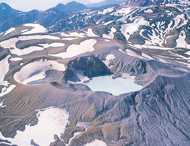 Joshin'etsu Kogen National Park
Designation: 1949/09/07
Area: 189,062 ha
This park is the second largest national park in Japan, and extends through Gunma, Nagano and Niigata prefectures. This park features a number of volcanoes including Mt. Asama, Mt. Myoko and Mt. Tanigawa, which are 2,000m class. The Shiga, Myoko and Sugadaira plateaus can be seen in this park.
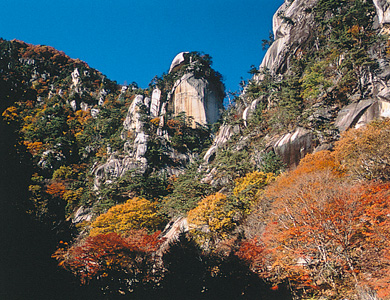 Chichibu-Tama-Kai National Park
Designation: 1950/07/10
Area: 126,259 ha
There are many coniferous and broadleaf trees and old stratum mountains such as Mt. Kumotori and Mt. Mitake. Near Tokyo, this park provides the headwaters for the Arakawa, Chikuma and Tama rivers. Natural forests and gorges offer good recreational sites. Mt. Mitake and Mt. Mitsumine are ancient places of mountain worship.
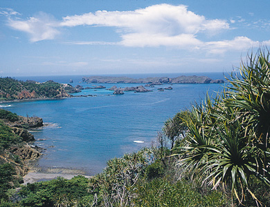 Ogasawara National Park
Designation: 1972/10/16
Area: 6,099 ha
This park is composed of over 30 islands, including the two main islands of Chichijima and Hahajima. The Ogasawara archipelago is located 1,000-1,200 km south of Tokyo. It is the smallest subtropical national park in Japan. The main feature of this park is its many indigenous plants and animals.
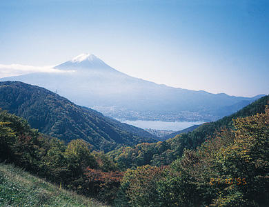 Fuji-Hakone-Izu National Park
Designation: 1936/02/01
Area: 121,714 ha
Mt. Fuji (3,776m), the highest peak in Japan, has aoki-gahara woodlands and five dammed lakes at its vast foot. In Hakone, Lake Ashinoko, and volcanoes such as Mt. Kamiyama, Mt. Koma-gatake and Sengoku-hara make miniature garden-like views. Izu has wonderful views of the Amagi mountain range and the seacoast. The Izu-Shichito (Seven Islands) are rich in peculiar nature views.
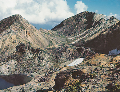 Hakusan National Park
Designation: 1962/11/12
Area: 47,700 ha
Hakusan has been regarded as one of the three most sacred mountains in Japan, along with Mt. Fuji and Mt. Tateyama, and has long been the object of religious worship. This park is rich in alpine plants. Many plants have been named after Hakusan. This area is famous as a habitat for black bears and antelopes.
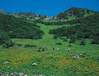 Minami Alps National Park
Designation: 1964/06/01
Area: 35,752 ha
This park extends into Yamanashi, Nagano and Shizuoka prefectures. There are many mountains over 3,000m such as Mt. Kitadake (3,192m), the second highest peak in Japan. Alpine plants live in Mt. Kitadake and Mt. Senjogatake, and indigenous plants can also be seen in this area.
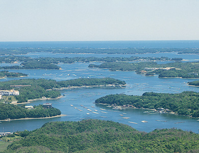 Ise-Shima National Park
Designation: 1946/11/2
Area: 55,544 ha
This park contains islets and bays such as Toba, Matoya, Ago and Gokasho. Ise-Jingu Shrine is important religiously, historically and culturally. There are natural forests formed by cedars and Japanese red pines behind the shrine.
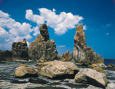 Yoshino-Kumano National Park
Designation: 1936/02/01
Area: 59,798 ha
The central mountainous area of the Kii Peninsula and meandering rivers and seashore in the southeastern part of the peninsula form this park. Mt. Yoshino is noted for its cherry blossoms, and Mt. Omine is worshipped by ascetic devotees. There are many cliffs along the coast from Owase to the Shiono Promontory. Various kinds of scenery can be seen in this area.
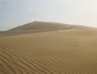 San'in Kaigan National Park
Designation: 1963/07/15
Area: 8,784 ha
This is a marine park that covers the 75km-long seacoast from Amino of Oku-Tango Peninsula to the sand dunes of Tottori. There are beautiful caves eroded by seawater. One of the main features of this park are the sand dunes of Tottori, some of which reach the height of 100m. There are plants such as Hamabohu (Glehnia) which are peculiar to the sand dunes and the severe environment of this area.
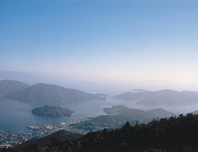 Setonaikai National Park
Designation: 1934/03/16
Area: 62,790 ha
This park contains about 3,000 islets. The park features scenery of the calm inland sea and many islands. One such view is of the Bisan Archipelago from Mt. Washu. The white beach sand and green pines, such as those found on along the Shibukawa coast and Keino-Matsuno, as well as cultivated land present scenery of harmonious beauty.
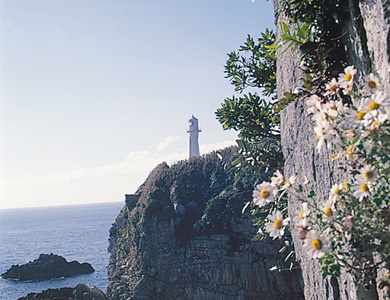 Ashizuri-Uwakai National Park
Designation: 1972/11/10
Area: 11,166 ha
Hakusan has been regarded as one of the three most sacred mountains in Japan, along with Mt. Fuji and Mt. Tateyama, and has long been the object of religious worship. This park is rich in alpine plants. Many plants have been named after Hakusan. This area is famous as a habitat for black bears and antelopes.
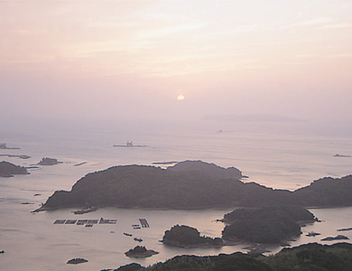 Saikai National Park
Designation: 1955/03/16
Area: 24,646 ha
This park consists of more than 400 islands, large and small, including Hirado, the Kujukushima Islands, and the Goto (Five Islands) Archipelago, extending over the northwestern extremity of Kyushu. The Goto Islands have high cliffs, and Fukue Island has rare volcanic formations (aspite-homate, or cinder-cone)
 Unzen-Amakusa National Park
Designation: 1934/03/16
Area: 28,287 ha
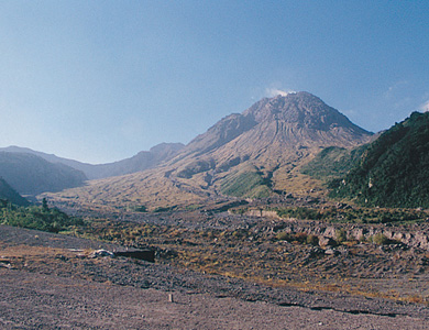
This park is located in the middle of the Shimabara Peninsula, and the islands of Amakusa. The Unzen area lies in the hillside of Mt. Fugen, which is famous for the volcanic activity which occurred in 1990. The Unzen area has many hot springs, and is a summer resort. The Amakusa area has 120 islands, large and small, in the Ariake and Yatsushiro Seas.
 Aso-Kuju National Park
Designation: 1934/12/04
Area: 72,678 ha
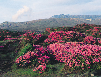
This mountainous park has many volcanoes and the world's largest caldera basin, whose circumference is about 90km. The Aso area has a magnificent view of Aso-Gogaku Five Mountains, including meadows and the active volcano, Mt. Naka-Dake. The Kuju Range and Mt. Yufu-Dake offer great views of the Kuju area. The region is famous for its wild azaleas.
 Kirishima-Yaku National Park
Designation: 1934/03/16
Area: 57,084 ha
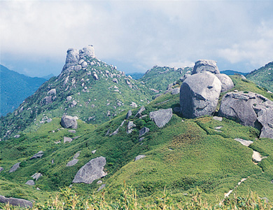
In the Kirishima area, there are over 20 volcanoes such as Mt. Karakuni, and natural forests formed by oaks, Japanese red pines, etc. at the foot of the mountains. An active volcano and Sakurajima Island are located in the Kinko Bay area. Yakushima Island is famous for Yaku-sugi (Japanese cedars that are over 1,000 years old) such as Jomon-sugi and Daio-sugi. The area is designated as a World Natural Heritage site.
 Iriomote National Park
Designation: 1972/05/15
Area: 12,506 ha
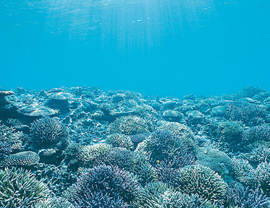
This park contains Iriomote Island and other Islands. Roughly 80% of Iriomote Island is covered with subtropical trees, and mangroves can be seen in the estuary of the Nakama River. There are many rare animals on Iriomote Island such as the Iriomote wildcat. There is a coral reef stretching between Taketomi Island and Ishigaki Island creating the largest coral reef in Japan.
This list of the National Parks of Japan, as well as the pictures, are from the Ministry of the Environment (MOE) of Japan, from the following web site : www.env.go.jp/en/np. Reproduced following terms of the copyrights.
The general information on the National Parks are taken from source : Wikipedia.